The Island
The Isle of Man Beyond the Course
The island around the racing: Douglas, Ramsey, Peel and Castletown, Snaefell and the Laxey Wheel, Tynwald, the Manx language and getting around by rail.
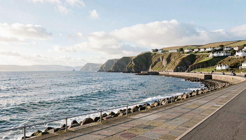
The Isle of Man sits in the middle of the Irish Sea, roughly equidistant from England, Ireland, Scotland and Wales. It is about 33 miles long and 13 miles wide at its broadest point, with a population of around 84,000 people. For two weeks a year it hosts the TT, and for the rest of the year it is a quiet island with its own parliament, its own language and a landscape of hills, coast and farmland. This guide introduces the place around the racing.
A crown dependency, not a county
The Isle of Man is a self-governing British Crown Dependency. It is not part of the United Kingdom, and it is not a member of the European Union. It makes its own laws, sets its own taxes and runs its own courts, while the United Kingdom handles defence and represents the island abroad. The head of state is the monarch, who holds the title Lord of Mann and is represented on the island by a Lieutenant Governor.
That constitutional position explains a great deal about the island, including how a motorcycle race came to be held on its public roads in the first place. The Manx parliament could permit what the mainland prohibited, and it did so in 1907 for the first Tourist Trophy.
Tynwald and the Manx identity
The island's parliament is Tynwald, which claims to be the oldest continuously operating legislature in the world, with origins in the Norse period more than a thousand years ago. It has two branches, the House of Keys, which is directly elected, and the Legislative Council. Once a year, on Tynwald Day in early July, the court meets outdoors at St John's, where the laws are promulgated in both English and Manx.
Manx is the island's own Celtic language. It declined almost to extinction in the twentieth century and has been revived through education and public use. A visitor will see it on road signs, on the Tynwald ceremony and in place names, many of which are Norse or Manx in origin. The three legs symbol on the island's flag, the triskelion, carries the motto Quocunque Jeceris Stabit, which means wherever you throw it, it will stand.
The towns
Douglas is the capital and the largest town, and it was granted city status in 2024. It sits on the east coast and contains the TT Grandstand, the start and finish of the Mountain Course, the ferry terminal and the main shopping streets. Its promenade faces a wide bay, and horse trams still run along it in summer.
Ramsey lies in the north and marks the point where the course turns inland onto the mountain. Peel is on the west coast, with a castle and a working harbour, and Castletown in the south was the island's ancient capital, with Castle Rushen at its centre. Each of the four towns has a distinct character, and each is within a short drive of the others.
The landscape and the summit
The island has a central mountain mass with Snaefell at its highest point, about 2,036 feet (621 metres) above sea level. That is the summit of the island, and it is a different place from the highest point of the TT course, which is at Hailwood's Height on the mountain road at about 1,385 feet. Around the hills the land falls away to farmland, glens and a rocky coastline.
The landscape is unusually treeless, a result of exposure and grazing history, which is why the hills look smooth and green and why the views open out so quickly. The glens, the coastal paths and the mountain railway are covered in the guide to island sights away from the racing.
Getting around
The island has a network of buses linking the towns and the main villages, and a set of heritage railways that are attractions in their own right. The Manx Electric Railway runs along the east coast, the Snaefell Mountain Railway climbs to the summit, and a steam railway runs in the south. During the TT the timetables change and the roads around the course close, so a visitor should check the day's arrangements rather than rely on a normal service.
Distances are short. The island can be crossed in under an hour outside race periods, and the whole of the course can be driven in normal traffic on a quiet day. During the TT the same journey can take much longer, because the course closes and traffic is diverted around it.
Why the island matters to the racing
The TT is not held on the Isle of Man by accident. It is held there because the island has its own laws, its own roads and a long habit of welcoming visitors to a race that could not exist anywhere else. The relationship runs both ways: the event brings tens of thousands of visitors each year, and the island's identity is bound up with a race that has been run on its roads for more than a century.
A reader who wants the racing explained can start from the guide to the TT races. A reader who wants to watch it can begin with the guide to watching the TT. A reader who wants the island's own story will find it summarised at Wikipedia, and its geography is visible on any lap of the course.
The island's economy and daily life are also shaped by its position. Finance and tourism are significant, and the TT fortnight is one of the busiest periods of the year for hotels, ferries and shops. Outside the racing season the pace is slower, and the same roads that carry racing machines in June carry farm traffic, buses and visitors on holiday.
The Island
Island Sights and Days Away From Racing
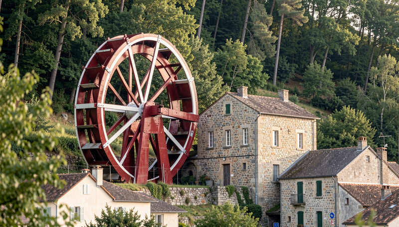
What to see on the Isle of Man away from the racing: the Laxey Wheel, Snaefell by mountain railway, Peel Castle, the Manx Museum and the coast.
The Laxey Wheel, Snaefell by rail, castles and the coast.